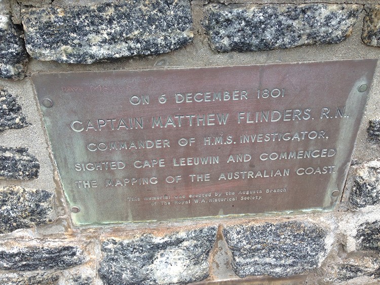
Lesson plans put WAMSI data in schools

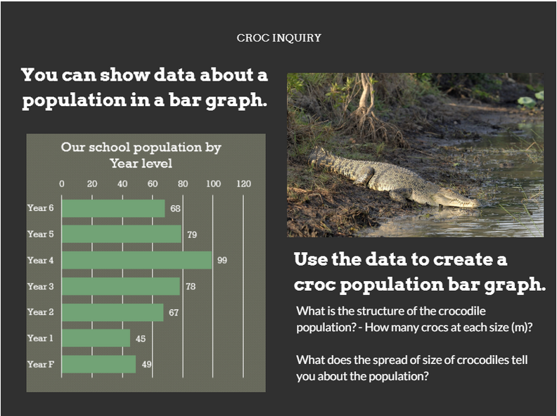
Lesson plans taking data from real research projects are now online to provide students with the opportunity to develop their data science skills based on crocodile and whale surveys.

An initiative by Western Australian Marine Science Institution Data Manager Luke Edwards working with Kimberley Marine Research Program project leader Kelly Waples, Education Services Australia’s Richard Martin and Australian Data Science Education Institute’s Dr Linda McIver has produced a series of online educational resources on Western Australia’s Kimberley region.

It provides a resource for teachers to assist them to develop data science skills using engaging real-life datasets.  It also helps teachers deliver the new Digital Technologies curriculum and contributes to the Digital Technologies Hub resources.


“Having data resources available to teachers based on actual research results from the Western Australian marine environment is very rare,” Luke Edwards said.

“Using real data provides students with much more motivation to learn data science skills and solve real life problems.

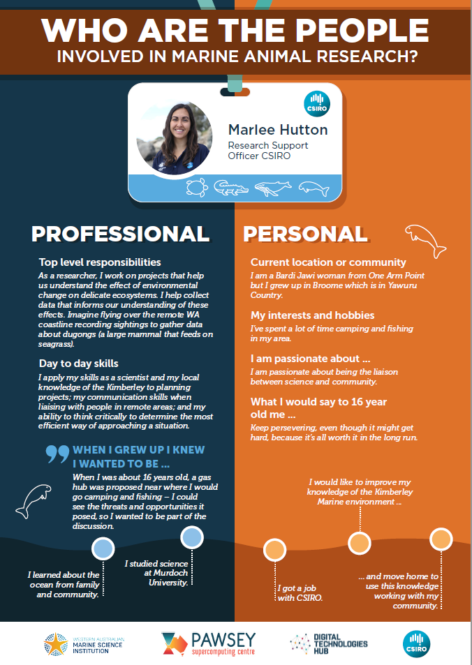
“We’re also producing some career profiles on our WA scientists to show students the background some of our scientists are from and the pathways they have taken to enter their profession.” 


The resource was launched during Data Science Week and is available to primary and secondary teachers to use in their classrooms.  

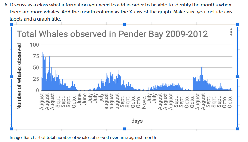
Lesson plans for years 5-6 and 7-8 using datasets on whales and crocodiles are now available to teachers online at Education Australia’s Digital Technologies Hub with lesson plans on dugongs and turtles soon to me made available.


The education resources have some great ideas for assessment in Digital Technologies. Each topic shows a sequence of learning with a summary, brief description, suggested learning activities, supporting resources and assessment ideas.

Data Science Week aims to bring together a community of data scientists across Australia to network and discuss trending topics and ideas across domains. This year’s events showcased a range of organisations including the Pawsey Supercomputing Centre and WA Data Science Innovation Hub with a focus on women in data science.

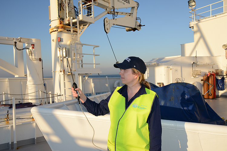
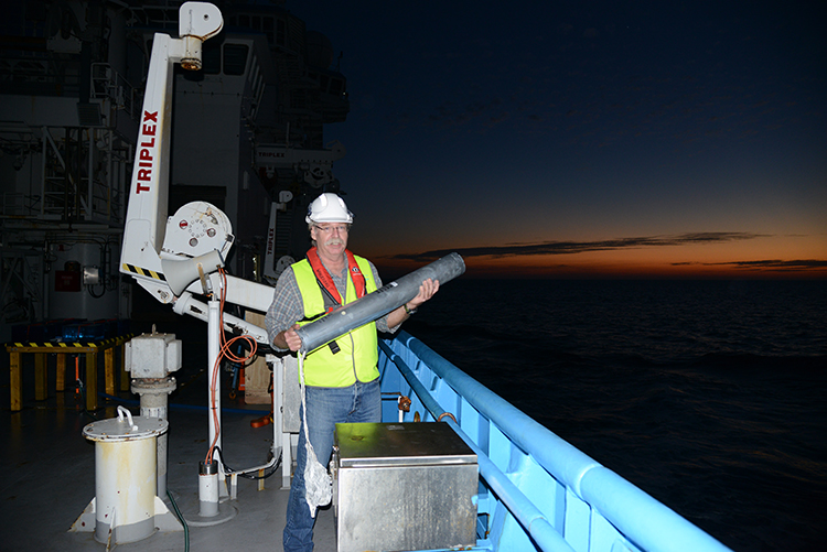
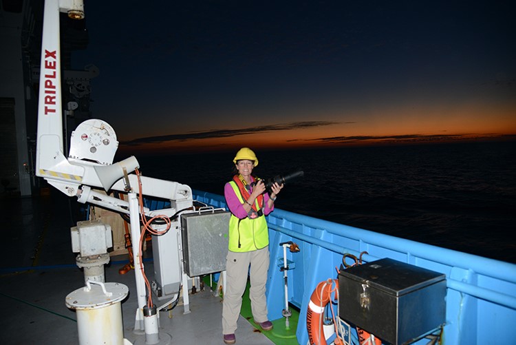
The online education resources are based on data produced for four of the 23 projects conducted as part of WAMSI’s Kimberley Marine Research Program.

For more information email: info@wamsi.org.au


The $30 million Kimberley Marine Research Program is funded through major investment supported by $12 million from the Western Australian government co-invested by the WAMSI partners and supported by the Traditional Owners of the Kimberley.

Category: 

Kimberley Marine Research Program

Testing, Testing, 1,2,3! – One Ten East log

One Ten East Logs from the IIOE-2 voyage aboard RV Investigator are being posted on the WAMSI website during the month long voyage.


By Prof Lynnath Beckley

The RV Investigator departed Fremantle yesterday afternoon after loading equipment and supplies for our month-long voyage as part of the second International Indian Ocean Expedition. Everyone is finding their sea legs and adapting to the 24/7, 12 hours on and 12 hours off watch system.

Today, as we traverse the 1000 km towards our first station on 110°E, we stopped to do some equipment testing and personnel training so that everyone could become familiar with the equipment, procedures and safety involved with oceanographic sampling.

We are currently about 120 km west of Cape Leeuwin, one of the world’s “Great Capes”. Remarkably, at Cape Leeuwin there is a plaque commemorating the fact that on 6th December 1801, Captain Mathew Flinders, Commander of HMAS Investigator, sighted Cape Leeuwin and started mapping the Australian coast. Now, on the modern 93m RV Investigator, we are on our way to map the south-east Indian Ocean repeating an oceanographic voyage conducted way back in May and June 1963 by the HMAS Diamantina as part of the first International Indian Ocean Expedition.


The present-day inscription at Cape Leeuwin dedicated to Captain Matthew Flinders, RN whom sighted Cape Leeuwin and commenced mapping of the Australian coast on 6 December 1801. Photo: Prof Lynnath Beckley


“Lights, sound, camera, action” could well have been the call today as we started our testing. Prof David Antoine’s optics team from Curtin University got their many instruments designed to examine light in the ocean up and running. Likewise, using sonobuoys, Curt and Micheline Jenner are already busy monitoring sound from whales as part of their ongoing work for the Australian Department of Defence. Micheline is also our resident photographer and has been busy with her brace of cameras documenting the activities of our 40 scientists and technicians.

Charlotte Robinson from Curtin University, part of David Antoine’s optics team holds a critical piece of their equipment. Photo: Micheline Jenner.


We also tested the CTD rosette which is a critical piece of equipment for all the researchers as we document the physical, chemical and biological properties of the water column. When it is brought back on board, it has over 400 L of water sampled from a range of depths in the ocean from which we can examine nutrients, microbes, genetics, pigments and get water to run a range of experiments such as primary production, nitrogen uptake and grazing by micro-zooplankton.

The zooplankton team were also busy testing their extensive arsenal of nets of various configurations and mesh sizes so that they can examine the poorly understood pelagic south-east Indian Ocean food web from tiny phytoplankton through to deep sea lantern fishes.

Curt Jenner deploying the first sonobuoy of the IN2019_V03 voyage to monitor the evening fish chorus. Photo: Micheline Jenner.

Micheline Jenner is ready, willing and able to capture the activities of the 40-member scientific team as well as any whales, dolphins and seabirds that stray within the ship’s field of view. Photo: Curt Jenner.


This research is supported by a grant of sea time on RV Investigator from the CSIRO Marine National Facility.

Be sure to follow the daily posts of our One Ten East Logs from the IN2019_V03 aboard RV Investigator at https://iioe-2.incois.gov.in and www.wamsi.org.au .

In the Wake of HMAS Diamantina – One Ten East log

We are about to go through immigration and throw off our lines at 3pm. Great sunny day here in Freo. Hope the weather holds! This is the second log from the voyage. Daily logs will be posted on the WAMSI website during the month long voyage

By Lynnath Beckley

On 14th May 2019, the Research Vessel Investigator will depart Fremantle on an oceanographic voyage to the 110°E meridian in the south-east Indian Ocean. This voyage will be following in the wake of the HMAS Diamantina, which in the 1960s, took Australian scientists to study the physical, chemical and biological oceanography of the same region as part of the first International Indian Ocean Expedition. During the 2019 voyage, which is Australia’s major contribution to the second International Indian Ocean Expedition (IIOE-2), a multi-national team of scientists will repeat many of the measurements made nearly six decades ago to ascertain if there have been significant changes in the pelagic ecosystem near the western extent of Australia’s Exclusive Economic Zone.


The frigate HMAS Diamantina was the primary vessel used by Australian scientists during the first International Indian Ocean Expedition. Photo courtesy of the Queensland Maritime Museum.


The HMAS Diamantina is the last remaining example of the British River Class frigates. Built in Australia and launched in 1944, the ship saw service in the latter part of World War 2 around Papua New Guinea, Solomon Islands, Bougainville and Nauru before being paid off into the Reserve in August 1946. It was recommissioned in June 1959 as an Oceanographic Research Ship under the command of Lieutenant Commander Bruce D Gordon RAN. The ship carried scientists from the CSIRO but also assisted the Australian Army survey team along the north-west Australia.

Although there is now a new HMAS Diamantina 2 (a Huon Class Minehunter) in the Australian fleet, the legacy of the original vessel lives on as a popular exhibit in the Queensland Maritime Museum in Brisbane. Furthermore, her name is immortalised in hydrography with one of the deepest areas in the Indian Ocean, the Diamantina Deep (around 8,000 m depth) in the Diamantina Fracture Zone some 1,100 km south-west of Fremantle named after the ship. On the RV Investigator voyage the connection with the Navy has been maintained with Captain Curt Jenner AM and Captain Micheline Jenner AM conducting research on underwater sound and whales for the Australian Defence Force. This voyage is supported by a grant of sea time on RV Investigator from the CSIRO Marine National Facility.

The original HMAS Diamantina, at her berth at the Queensland Maritime Museum in Brisbane. Photo courtesy of the Queensland Maritime Museum.


Eeva Leinonen, Vice Chancellor of Murdoch University (right), doing the honours and raising the second International Indian Ocean Expedition flag aboard RV Investigator in the Port of Fremantle. Captain Adrian Koolhof and Prof. Lynnath Beckley observed the proceedings. Photo: Micheline Jenner.

Be sure to follow the daily posts of our One Ten East Logs at IIOE 2 and WAMSI

In the Wake of HMAS Diamantina – One Ten East log

We are about to go through immigration and throw off our lines at 3pm. Great sunny day here in Freo. Hope the weather holds! This is the second log from the voyage. Daily logs will be posted on the WAMSI website during the month long voyage

By Lynnath Beckley

On 14th May 2019, the Research Vessel Investigator will depart Fremantle on an oceanographic voyage to the 110°E meridian in the south-east Indian Ocean. This voyage will be following in the wake of the HMAS Diamantina, which in the 1960s, took Australian scientists to study the physical, chemical and biological oceanography of the same region as part of the first International Indian Ocean Expedition. During the 2019 voyage, which is Australia’s major contribution to the second International Indian Ocean Expedition (IIOE-2), a multi-national team of scientists will repeat many of the measurements made nearly six decades ago to ascertain if there have been significant changes in the pelagic ecosystem near the western extent of Australia’s Exclusive Economic Zone.

The frigate HMAS Diamantina was the primary vessel used by Australian scientists during the first International Indian Ocean Expedition. Photo courtesy of the Queensland Maritime Museum.14

The HMAS Diamantina is the last remaining example of the British River Class frigates. Built in Australia and launched in 1944, the ship saw service in the latter part of World War 2 around Papua New Guinea, Solomon Islands, Bougainville and Nauru before being paid off into the Reserve in August 1946. It was recommissioned in June 1959 as an Oceanographic Research Ship under the command of Lieutenant Commander Bruce D Gordon RAN. The ship carried scientists from the CSIRO but also assisted the Australian Army survey team along the north-west Australia.

Although there is now a new HMAS Diamantina 2 (a Huon Class Minehunter) in the Australian fleet, the legacy of the original vessel lives on as a popular exhibit in the Queensland Maritime Museum in Brisbane. Furthermore, her name is immortalised in hydrography with one of the deepest areas in the Indian Ocean, the Diamantina Deep (around 8,000 m depth) in the Diamantina Fracture Zone some 1,100 km south-west of Fremantle named after the ship. On the RV Investigator voyage the connection with the Navy has been maintained with Captain Curt Jenner AM and Captain Micheline Jenner AM conducting research on underwater sound and whales for the Australian Defence Force. This voyage is supported by a grant of sea time on RV Investigator from the CSIRO Marine National Facility.

Be sure to follow the daily posts of our One Ten East Logs at IIOE 2 and WAMSI

Flying the Flag for the International Indian Ocean Expedition – One Ten East log

Today is loading day in the port of Fremantle and this is the first log from the voyage. Daily logs will be posted on the WAMSI website during the month long voyage.
 
By Lynnath Beckley 
 
The second International Indian Ocean Expedition (IIOE-2) is motivated by the need to advance knowledge about geological, oceanic and atmospheric processes and their interactions in the Indian Ocean because they influence millions of people around its rim. The Expedition aims to quantify how these dynamics affect climate, marine biogeochemical cycles, ecosystems and fisheries, both within the region, and globally.
 
At the annual IIOE-2 Steering Committee meeting in March 2019 in Port Elizabeth, South Africa, Prof. Lynnath Beckley, Chief Scientist of the upcoming RV Investigator voyage (IN2019_V03) was presented with the IIOE-2 flag.
 
Representing the co-sponsors, Dr Satheesh Shenoi from the Indian Ocean regional alliance of the Indian Ocean Global Ocean Observing System (IOGOOS) and Dr Peter Burkill of the Scientific Committee on Oceanic Research (SCOR) made the presentation and the flag will be proudly flown during the voyage. 
 
 
Above: Prof. Lynnath Beckley being presented with the IIOE-2 Flag by Dr Satheesh Shenoi and Dr Peter Burkill. Photo: Prof Raleigh Hood.


The voyage which leaves from Fremantle on 14th May will be repeating the 110°E meridian line in the south-east Indian Ocean that was last examined in 1963 by Australian scientists aboard the HMAS Diamantina during the first IIOE. The IN2019_V03 voyage addresses several of the research themes in the IIOE-2 Science Plan, particularly those pertaining to human impacts on the Indian Ocean, boundary current dynamics, ocean circulation, climate variability and change and the unique physical, biogeochemical and ecological features of the Indian Ocean.
 
This research is supported by a grant of sea time on RV Investigator from the CSIRO Marine National Facility.
 
More information available at https://iioe-2.incois.gov.in/


Flying the Flag for the International Indian Ocean Expedition – One Ten East log

Today is loading day in the port of Fremantle and this is the first log from the voyage. Daily logs will be posted on the WAMSI website during the month long voyage.

By Lynnath Beckley

The second International Indian Ocean Expedition (IIOE-2) is motivated by the need to advance knowledge about geological, oceanic and atmospheric processes and their interactions in the Indian Ocean because they influence millions of people around its rim. The Expedition aims to quantify how these dynamics affect climate, marine biogeochemical cycles, ecosystems and fisheries, both within the region, and globally.

At the annual IIOE-2 Steering Committee meeting in March 2019 in Port Elizabeth, South Africa, Prof. Lynnath Beckley, Chief Scientist of the upcoming RV Investigator voyage (IN2019_V03) was presented with the IIOE-2 flag.

Representing the co-sponsors, Dr Satheesh Shenoi from the Indian Ocean regional alliance of the Indian Ocean Global Ocean Observing System (IOGOOS) and Dr Peter Burkill of the Scientific Committee on Oceanic Research (SCOR) made the presentation and the flag will be proudly flown during the voyage.

The voyage which leaves from Fremantle on 14th May will be repeating the 110°E meridian line in the south-east Indian Ocean that was last examined in 1963 by Australian scientists aboard the HMAS Diamantina during the first IIOE. The IN2019_V03 voyage addresses several of the research themes in the IIOE-2 Science Plan, particularly those pertaining to human impacts on the Indian Ocean, boundary current dynamics, ocean circulation, climate variability and change and the unique physical, biogeochemical and ecological features of the Indian Ocean.

This research is supported by a grant of sea time on RV Investigator from the CSIRO Marine National Facility.

More information available at https://iioe-2.incois.gov.in/


Australian voyage to reveal climate change effects in Indian Ocean – One Ten East log

One Ten East Logs from the IIOE-2 voyage aboard RV Investigator will be posted on the WAMSI website during the month long voyage.

Around 60 years ago, marine scientists aboard ships from 14 countries combined their efforts to explore the largest unknown area of earth, the deep waters and seabed of the Indian Ocean. This expedition generated a wealth of information and formed the basis of our scientific understanding about the Indian Ocean basin. So why do we need to do it all again?

An Australian voyage retracing part of the historic first International Indian Ocean Expedition expects to reveal the effects of climate change on the physics, chemistry and biology of the waters of the southeast Indian Ocean.

Professor Lynnath Beckley from Murdoch University is the Chief Investigator on this voyage of the second International Indian Ocean Expedition (IIOE2) which sets sail on Tuesday May 14th from Fremantle, Western Australia.

Forty marine scientists and technicians from 18 institutions will spend 32 days at sea on the CSIRO Marine National Facility research vessel Investigator, sampling along the 110°E longitudinal meridian in the deep ocean, approximately 500-600 km offshore of the continent.

Professor Beckley said retracing the journey would provide a unique snapshot into how much the ocean and marine life had changed over time.

“There is published scientific evidence that, in the past five decades, there has been surface water warming of over one degree Celsius in the south-east Indian Ocean” Professor Beckley said.

“There are also indications that the deepest, coldest waters in the ocean, those that are formed around Antarctica, are rapidly warming and freshening. These changed waters are moving towards the Indian Ocean and will have huge ramifications for global ocean circulation patterns.

“This expedition will provide some of the first ecological data about the oceanic food web in several of Australia’s recently established south-west and north-west marine parks, which extend out to the edge of Australia’s Exclusive Economic Zone.”

The researchers will investigate the whole oceanic ecosystem including physical processes, bio-geochemistry, nitrogen sources, microbes, primary production, zooplankton, mesopelagic fishes, food webs and whales.

“Essentially, our multi-disciplinary team will be investigating everything we can from physics to fish with some whales on the side!” Professor Beckley said.

“Technology has advanced significantly since the first expedition and we now have the opportunity to discover how microbes contribute to the functioning of the Indian Ocean, which was not able to be studied last time because the genomics techniques were not yet developed”.

“We will also be checking the accuracy of satellite remote sensing of ocean colour by measuring levels of chlorophyll and other pigments in the water column. This will help us evaluate production by algae and carbon sequestering on an ocean basin scale.”

A team of scientists and postgraduate students from seven Australian universities – Murdoch University, Curtin University, University of Tasmania, University of Technology Sydney, Macquarie University, University of New South Wales and University of Western Australia – will accompany Professor Beckley on the 2019 expedition. Researchers from the University of Auckland, University of Maryland Center for Environmental Science, Scripps Institution of Oceanography, Spanish National Research Council, Alfred Wegener Institute, NOAA, CSIRO, Australian Institute of Marine Science, Centre for Whale Research (WA) Inc.and the Australian Department of Defence will also be conducting research on board the voyage.

The voyage is a major part of Australia’s contribution to the UNESCO-led IIOE-2 mission and Australia’s Marine National Facility.

The voyage embarked on 14 May from Fremantle and returns on 14 June. More information on the second International Indian Ocean Expedition can be found at https://iioe-2.incois.gov.in/

Australian voyage to reveal climate change effects in Indian Ocean – One Ten East log

One Ten East Logs from the IIOE-2 voyage aboard RV Investigator will be posted on the WAMSI website during the month long voyage.

Around 60 years ago, marine scientists aboard ships from 14 countries combined their efforts to explore the largest unknown area of earth, the deep waters and seabed of the Indian Ocean. This expedition generated a wealth of information and formed the basis of our scientific understanding about the Indian Ocean basin. So why do we need to do it all again?

An Australian voyage retracing part of the historic first International Indian Ocean Expedition expects to reveal the effects of climate change on the physics, chemistry and biology of the waters of the southeast Indian Ocean.

Professor Lynnath Beckley from Murdoch University is the Chief Investigator on this voyage of the second International Indian Ocean Expedition (IIOE2) which sets sail on Tuesday May 14th from Fremantle, Western Australia.

Forty marine scientists and technicians from 18 institutions will spend 32 days at sea on the CSIRO Marine National Facility research vessel Investigator, sampling along the 110°E longitudinal meridian in the deep ocean, approximately 500-600 km offshore of the continent.

Professor Beckley said retracing the journey would provide a unique snapshot into how much the ocean and marine life had changed over time.


ABOVE: Chief Investigator Professor Lynnath Beckley gets ready to set sail  onboard the CSIRO Marine National Facility research vessel Investigator


“There is published scientific evidence that, in the past five decades, there has been surface water warming of over one degree Celsius in the south-east Indian Ocean” Professor Beckley said.

“There are also indications that the deepest, coldest waters in the ocean, those that are formed around Antarctica, are rapidly warming and freshening. These changed waters are moving towards the Indian Ocean and will have huge ramifications for global ocean circulation patterns.

“This expedition will provide some of the first ecological data about the oceanic food web in several of Australia’s recently established south-west and north-west marine parks, which extend out to the edge of Australia’s Exclusive Economic Zone.”

The researchers will investigate the whole oceanic ecosystem including physical processes, bio-geochemistry, nitrogen sources, microbes, primary production, zooplankton, mesopelagic fishes, food webs and whales.

“Essentially, our multi-disciplinary team will be investigating everything we can from physics to fish with some whales on the side!” Professor Beckley said.

“Technology has advanced significantly since the first expedition and we now have the opportunity to discover how microbes contribute to the functioning of the Indian Ocean, which was not able to be studied last time because the genomics techniques were not yet developed”.

“We will also be checking the accuracy of satellite remote sensing of ocean colour by measuring levels of chlorophyll and other pigments in the water column. This will help us evaluate production by algae and carbon sequestering on an ocean basin scale.”

A team of scientists and postgraduate students from seven Australian universities – Murdoch University, Curtin University, University of Tasmania, University of Technology Sydney, Macquarie University, University of New South Wales and University of Western Australia – will accompany Professor Beckley on the 2019 expedition. Researchers from the University of Auckland, University of Maryland Center for Environmental Science, Scripps Institution of Oceanography, Spanish National Research Council, Alfred Wegener Institute, NOAA, CSIRO, Australian Institute of Marine Science, Centre for Whale Research (WA) Inc.and the Australian Department of Defence will also be conducting research on board the voyage.

The voyage is a major part of Australia’s contribution to the UNESCO-led IIOE-2 mission and Australia’s Marine National Facility.

The voyage embarked on 14 May from Fremantle and returns on 14 June. More information on the second International Indian Ocean Expedition can be found at https://iioe-2.incois.gov.in/