An artist’s expedition to the deep sea Bremer Canyon

The Falkor research vessel at this moment is floating above the Bremer Canyon. Below us the remotely controlled vehicle explores the depths beaming up footage. It is operated from the control room by the engineers who navigate the cliffs and sandy flats of the canyon and employ almost surgical precision to collect particular specimen.
This exploration builds on the research of Dr Macolm McCulloch begun years ago. It is exciting that this team of scientists from institutions around the world, led by our own Dr Julie Trotter, is undertaking this work with state of the art equipment.
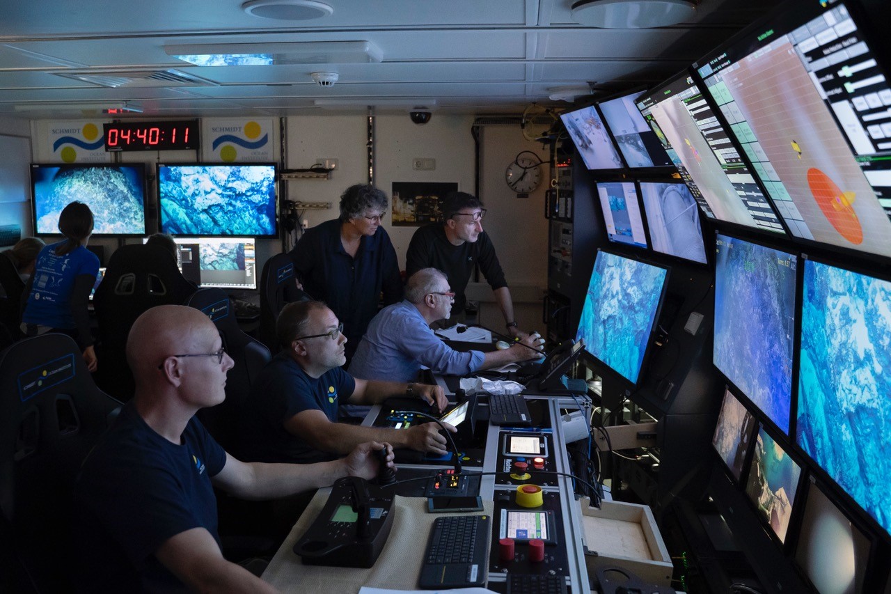 |
| The RV Falkor control room |
The Remotely Operated Vehicle (ROV), the conductivity, temperature, and depth (CTD), and the Multibeam instruments have been in operation harvesting information throughout the last four weeks. We have only one week left of this amazing treasure hunt. The CTD has harvested water samples at every depth that are being analysed against a number of criteria. The benthic topographic maps that have been almost constantly generated during this voyage will fill in the gaps of our knowledge and understanding of these three great West Australian canyons.
 |
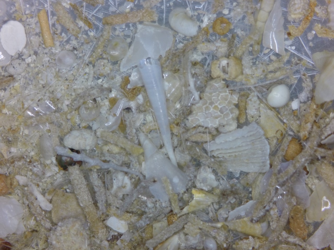 |
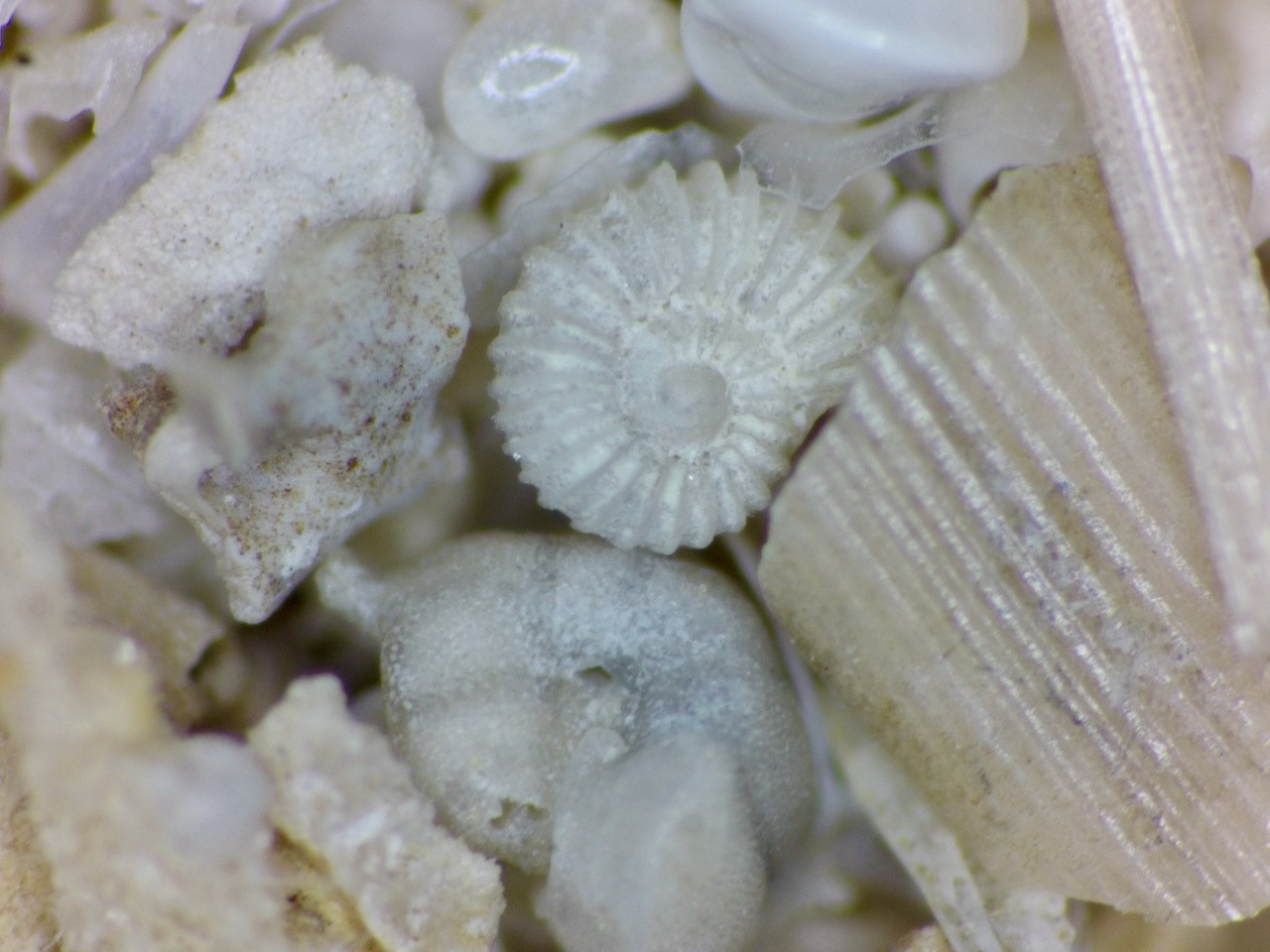
| Photos of foraminifera brought up from the depths |
It has been fascinating to watch the video footage of the deep where no sunlight goes where communities of corals and associated animal live far beyond our imagination. Some of these species we gaze upon have never been seen before. The video footage beamed up and samples brought to the surface will be the subject of research for years as their secrets are carefully unravelled in the laboratories of the scientists contributing to this exciting endeavour.
I continue drawing, painting and photographing these wonders.
Everyone is invited to watch the live steam of ROV footage narrated by the Dr Marco Taviani of the Institute of marine Sciences in Bologna. Marco’s inspired story telling takes one deep into the past from our present day vantage to understand the secrets of these deep silent places.
The link on the Schmidt Oceans Institute website to watch live streams is Live from R/V Falkor on the Schmidt Ocean Institute website.
The best way to get updates about when live streaming is happening is to subscribe to the YouTube channel – and get email updates everytime livestreaming begins. Events are promoted on the social media channels, so if you follow on Facebook or Twitter, you will get updates.
Buty Niemowl?ce